
How Scientists Reconstruct Medieval Tsunami History
Discover how scientists use sediment layers, archaeological patterns, and medieval chronicles to reconstruct tsunamis that struck centuries before modern instruments.
Updated:
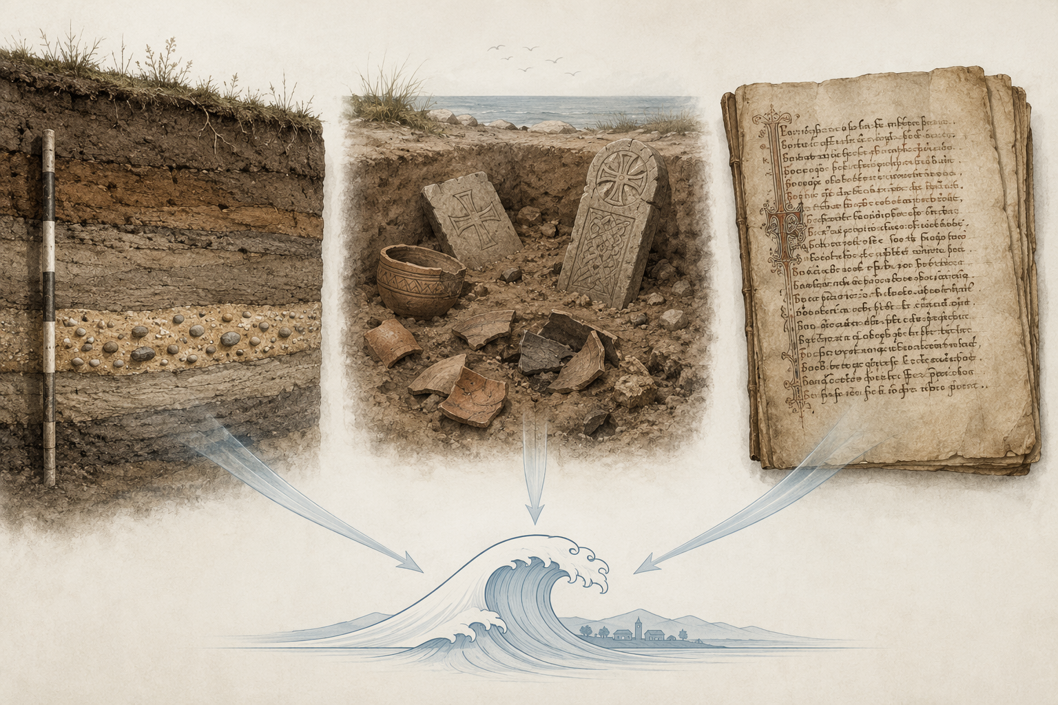
A medieval tsunami history study starts with a missing tool kit: no tide gauges, no satellites, no seismometers, and usually no contemporary field report. The answer is not a single substitute record. Scientists build the case by letting one imperfect line of evidence check another until a flood layer, a damaged settlement pattern, and a dated text point to the same event.
- Geological deposits show whether seawater reached inland, how thick the layer was, and whether it thins away from the coast.
- Archaeological surveys show which settlements changed, were abandoned, survived, or were rebuilt after the wave.
- Historical records preserve timing, perception, and sometimes the delay between the event and the news.
How a trench turns into a tsunami hypothesis
At Stromboli, researchers dug three stratigraphic trenches 170-250 m from today's shoreline, with a combined length of about 80 m. The cuts exposed three distinct tsunami sand layers containing beach pebbles. The thickest deposit, LTd, reached about 40 cm near the coast and thinned to 5 cm inland. That shape matters because an inland-thinning marine layer is easier to distinguish from a local washout or an ordinary storm deposit. [1]
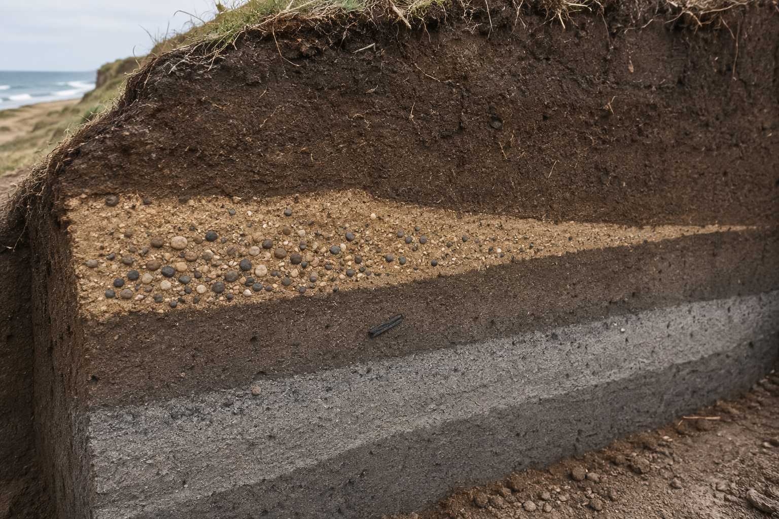
The layer does not date itself. Charcoal below the deposit gave a calibrated range of 1224-1298 AD, which is earlier than Petrarch's 1343 letter, so the radiocarbon result works as a maximum age rather than the event date. Coins and thermoluminescence dating of tiles narrowed the chronology further, and the study argued for a flank collapse around 1350 +/- 60. A medieval letter by Petrarch described a nocturnal 'sea storm' that destroyed ships inside and outside Naples harbor and killed hundreds; once the Stromboli layer was in hand, that vivid prose became something that could be checked instead of simply admired. [1]
What settlement patterns can show
Archaeology answers a different part of the question. In Aceh, a systematic survey of 1,029 archaeological sites along a 40-km coast documented more than 30,000 imported ceramic sherds and 5,800 Islamic gravestones. Ceramic abundance dropped from about 3,871 pre-1400 sherds to just 70 between 1400 and 1450, a 73% decline. Of those 70 sherds, 56 were found only at the elevated headland settlement of Lamri, which survived while 9 of 10 coastal settlements were destroyed. The pattern does not say only that something bad happened; it shows which places were wiped out, which place persisted, and where recovery could begin. The date is bracketed rather than exact, because it is inferred from the sharp decline before 1400 and changes in Chinese export ceramic types. [2]
What a diary preserves
Historical documents usually cannot prove inundation by themselves, but they can preserve timing and interpretation. Japanese court diaries such as Fujiwara no Munetada's Chuyuki recorded the 1096 Eicho earthquake from the Nankai Trough, with tsunami waves devastating Suruga and Ise bays. The Kyoto court first treated the shaking as an astrological omen and only learned of the tsunami 15 days later. That delay is not a side note; it shows what contemporaries knew, what they misunderstood, and how slowly news could travel. [3]

Why cross-checking matters
The point of this kind of work is not to make any one source do all the labor. NOAA's Global Historical Tsunami Database lists more than 1,200 confirmed tsunamis between 1610 BC and AD 2017, which is a reminder that medieval cases sit inside a much longer record. The methods stay modest for a reason: sediment can be erased, archaeological survival can be uneven, and written accounts can be vivid without being precise. When the lines converge, though, they let scientists say something stronger than any single trench, archive, or artifact count could say alone: unusual marine flooding reached inland, settlements were disrupted in measurable ways, and people noticed the event in the language and timing available to them. That is what makes the reconstruction credible.
References
- Three medieval tsunamis recognized at Stromboli — INGV, 2019
- Archaeological evidence for a medieval tsunami in Aceh — Proceedings of the National Academy of Sciences, 2019
- 1096 Eicho earthquake and tsunami — Environment & Society Portal Arcadia
- Historical Context — NOAA
Comments
Join the discussion with an anonymous comment.